|
|
| Line 1: |
Line 1: |
| − | Various northside climbers have hoped to find a rival to the southside venues but with limited success until the development of the Deer Park Crag in 2015.
| + | '''<span style="background-color:#ffff00">IF YOU ADD NEW ROUTES TO THE WIKI PLEASE ADD A POST TO THIS THREAD ON THE FORUM:</span>''' |
| | | | |
| − | Prior to that, climbers found various entertaining bits and pieces which nobody recorded until Jim Cooper explored the Head comprehensively in 2001 and 2002 and wrote down what he found. There are some worthwhile longer routes and many others which fall on the borderline of bouldering.
| + | http://forum.climbing.ie/index.php/topic,5422.0.html |
| | | | |
| − | The rock is mainly a quartzite and mudstone mix.
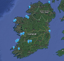
| + | [[File:MapThumb.png|none|thumb|link=https://www.google.com/maps/d/edit?mid=1CPSH_N4N3faP-wi9Z897XwEygiunPAgK&usp=sharing|alt=|Crag Map (work in progress)]] |
| | | | |
| − | In 2014/2015 a group of IMC climbers started developing the Muck Rock area above the Deer Park. Previously described on these pages as
| + | ==Introduction== |
| − | <blockquote>"Looks impressive from a distance but is invisible from its foot because of the rhododendron forest.<br />''(“Bluebell Gully of moderate difficulty and little interest, T Calvert, W R Perrott”, see Bill Perrott)''."</blockquote>
| |
| − | The coastal area is described starting from the start of the Sutton end of the Cliff Walk and following the coast to Balscadden Road at Howth Village. Cars can be parked at the junction of Strand Road and Shielmartin Road or on Shielmartin Road itself. The Cliff Walk can also be accessed from Ceannchor Road and The Summit.
| |
| | | | |
| − | The section with possible climbing is about one and two thirds kilometres long on either side of Drumleck Point, east of the Martello Tower at Sutton House and west of Doldrum Bay. It is closer to O’Connell Street than Dalkey Quarry!
| + | There are several websites actively recording new route and new boulder problem information: |
| | | | |
| − | While many of the sections worth exploring are affected by high tide and only about 7 metres high, there are significant parts 12 to 15 metres high some of which are accessible above high tide.
| + | [http://colmcille-climbers.com/gb-home/ Donegal] |
| | | | |
| − | Some sections of the rock have shaley dykes and inclusions but there is plenty of good rock. There is some excellent pink quartzite at the west (Sutton) end. Most of the crags face south west receiving the best of the afternoon sun or are in sheltered coves.
| + | [http://www.uniqueascent.ie/undiscovered_donegal Donegal PDF Downloads] |
| | | | |
| − | <display_map zoom="13">
| + | [http://www.mournesclimbers.com Mournes] |
| − | 53.36833, -6.092385~Warning Sign Slab (approx)
| |
| − | 53.367716, -6.090068~Red Rock
| |
| − | 53.366423, -6.088802~Check out the wall here
| |
| − | 53.36253, -6.082214~Sheep's Hole
| |
| − | 53.361019, -6.078888~Rusty Wall
| |
| − | 53.361531, -6.080691~Mussel Cove
| |
| − | 53.362044, -6.074404~Sandy Cove (Approx)
| |
| − | 53.362313, -6.071571~Candlesticks
| |
| − | 53.364669, -6.053289~Web's Castle Rock
| |
| − | 53.385752, -6.047668~Puck's Rocks
| |
| − | 53.386389, -6.058889~Cat Rock
| |
| − | 53.378665, -6.08127~Muck Rock
| |
| − | 53.375621, -6.078438~Lowest outcrop
| |
| − | </display_map>
| |
| | | | |
| − | ==Deer Park Crag==
| + | [http://www.theshortspan.com Bouldering in Ireland (TheShortSpan)] |
| | | | |
| − | [[File:DeerParkIntro.png|center|600px|]]
| + | Some of the above sites have forms where you can submit descriptions etc. and it may suit you to do that. However for your convenience this listing is also made available and we'll forward on any info received to the relevant guidebook editors. |
| | | | |
| − | '''Access''' Closest access is from Howth Castle/Deer Park golf course car park (5 mins) – crag is clearly visible from the car park. This is a public golf course and is on the Howth tourist trail, containing the Howth Transport Museum, Howth Castle and the much visited rhododendron forest and Muck Rock crag up behind the hotel on the right side.
| + | Alternatively just email the info to [mailto:newroutes@climbing.ie newroutes@climbing.ie] |
| | + | ==Crag List== |
| | + | ==Co. Antrim== |
| | + | [[Ballygalley Head]] |
| | | | |
| − | '''Approach''' From the car park walk around the right side of the golf club bar and follow the track leading to the rhododendron forest. Just past the sign “Flowers must not be picked” turn right and take the small narrow left hand track at the small boulder. After approx 30m take fainter left hand track heading upwards. Walk up this for approx 200m (2 mins), ignoring overgrown leftside scrambles, and take further left hand track heading up the steps. 30m along this is up through a rhododendron ‘tunnel’ on the left (the 2nd tunnel, not the 1st) is ‘De Northside’ face. From this 2nd tunnel access to the other sections of the crag is possible by using the rough track that runs along the base (see pic below). For ‘De Southside’ overhanging face just continue along the track for 20m to the next path junction. ‘De Alcove’ is the elevated grassy area between the two.
| + | [https://colmcille-climbers.com/route-list/?crag_no=23&Submit=++Go++ Dunseverick] (Colmcille Climbers) |
| | | | |
| − | '''Aspect''' The crag faces NW so gets sun from mid-afternoon till sunset. De Southside face has a more westerly orientation and gets the sun first. Because of its aspect it may take a while to properly dry out early in the season.
| + | [[Fairhead]] |
| | | | |
| − | ''Protection Ratings (PR)'': VG, G, M (Moderate), P (Poor)
| + | [[Garron Point]] |
| | | | |
| − | Climbs listed left to right.
| + | [https://colmcille-climbers.com/route-list/?crag_no=122&Submit=++Go++ Ramore Head] (Colmcille Climbers) |
| − | [[File:DeerParkMainNew.jpg|alt=|center|800x800px|Deerpark Crag Sections]]
| |
| | | | |
| | + | [https://colmcille-climbers.com/route-list/?crag_no=196&Submit=++Go++ Runkerry] (Colmcille Climbers) |
| | | | |
| − | ===Mayan Rock===
| + | [[Winter Climbing Glenariff]] |
| | | | |
| | + | [[Músaem Uladh]] |
| | | | |
| − | ''Mayan Rock Topo:''
| + | ==Co. Armagh== |
| − | [[File:MayanRockTopo.JPG|center|300px|]]
| |
| | | | |
| − | The following two routes are on Mayan Rock, a rock face found in the tree canopy to the left of Pine Tree Ledge:
| + | ==Co. Carlow== |
| | | | |
| − | '''Daoine Eile (HS 4b) 9m'''<br />''Niall S. Murphy, Alan Fogarty<br />''Follows the hand sized crack at the left side of the rock face to the top. Belay from trees.
| + | ==Co. Cavan== |
| | | | |
| − | '''Daoine Maithe (HVS 5a) 13m'''<br />''Niall S. Murphy, Rafal Barszczak<br />''Start at the same crack as Daoine, but traverse out right under the small bulge to the small cracks with good gear, continue straight up. Belay from trees.<br />
| + | [[Cloch An tSagairt / Carrignahasta]] |
| | | | |
| − | ===Maol Wall===
| + | [[Englishman's House Crag]] |
| | | | |
| − | [[File:MaolWall2.jpg|center|500px|]] | + | [[The Playbank]] |
| | | | |
| − | Short steep section of the crag which has three faces, one on the left, the main castle facing side and another face around the right side.
| + | ==Co. Clare== |
| | | | |
| − | '''Grainne (HVS? 4c) 9m'''<br />''Niall S. Murphy, Alan Fogarty<br />''A steep short and sweet route. Starts on the right side of the castle facing side of Maol Wall, just to the right of the large detached block, follow the small finger crack then tend rightward. Protection at the top of the route is small or lacking, caution is advised.
| + | [[Ailladie]] |
| | | | |
| − | '''Cooley Crack (VS 4b) 10m'''<br />''Niall S. Murphy<br />''The large obvious crack on the back of the righthand side of Maol Wall.
| + | [[Ailladie DWS Routes]] |
| − | [[File:Cooley crack.png|center|alt=|frameless|463x463px]] | |
| − | <br />
| |
| | | | |
| − | ===Pine Tree Ledge===
| + | [[Aill na Cronain]] |
| | | | |
| − | The easiest way to get to Pine Tree Ledge is from the 2nd tunnel described above in the "approach", once you reach the northside face just walk left along the rough track. Alternatively it can be reached by abseiling down "Navicula" or "Fire Cert" or scrambling down "Scram Bull" if you are confident enough in doing so.
| + | [[Aillnagapple]] |
| | | | |
| − | ''Pine Tree Ledge Topo:''
| + | [[Aran Islands]] |
| − | [[File:PineTreeLedgeDr.jpg|center|750x750px|Pine Tree Ledge Drone Shot]] | |
| | | | |
| | + | [[Ballyryan]] |
| | | | |
| − | '''Zambezi Nights (S 4a)12m'''<br />''Niall S. Murphy<br />''Start just to the right of "Cooley Crack", the climb goes up the corner/gully, good gear.
| + | [[Ballynahown]] |
| | | | |
| − | '''Squawk Code (HS 4b)12m'''<br />''Niall S. Murphy<br />''Scramble up onto the ledge to the left of the start of snotser, climb the short slab to gain the ledge below the steep wall, the climb goes up the obvious finger crack.
| + | [[Ceann Capaill]] |
| | | | |
| − | '''Snotser (HS 4b)18m'''<br />''Niall S. Murphy, Rafal Barszczak<br />''Scramble up the easily angled rock to a ledge. From the ledge climb the corner with the off width crack which leads to a short left tending ramp, climb the crack behind the ramp to the top. Or more easily follow the ramp.
| + | [[Cliffs Of Moher]] |
| − | [[File:Snotser2.png|center|thumb]] | |
| | | | |
| − | '''Fire Certificate (S 4a) 18m''' <br />''Kevin Coakley, Colm Peppard – 2015<br />''This climb is found in the center of the "Pine Tree Ledge" area. Start at a V groove in the rock and bridge up for 4m without protection on good holds. Clamber up the groove or the arête to top out on pine tree ledge, belay from the tree with backup.
| + | [[Croagh North/Rathborney Valley]] |
| − | [[File:FireCertStart.jpg|center|thumb]] | |
| | | | |
| − | '''Fire Certificate ''"Alternate Start"'' (S 4a)15m'''<br />''Niall S. Murphy,<br />''An alternative start that is a bit shorter but has some protection available in the wide crack that makes up the start. Two meters to the right of the "V-groove corner" start of "Fire Certificate" scramble up the small earth bank. Climb the crack, tend left at the top of the crack to join fire cert.
| + | [[Doolin]] |
| | | | |
| − | '''Navicula (S 4a)15m'''<br />''Niall S. Murphy<br />''Starts just to the right of Fire Cert Alt Start, climb the cracks on the right, which brings you out onto the open face, climb the face up to the pine tree.
| + | [[Eagles Rock]] |
| | | | |
| − | <br />[[File:Navicula2.png|center|thumb]]'''Dat Dere (S 4a)15m'''<br />''Niall S. Murphy,<br />''Start just left of the "roof" which is close to the ground, climb behind the tree and follow the righthand tending crack, belay from top out or continue up and left to the pine tree.
| + | [[Loop Head]] |
| | | | |
| − | '''Scram Bull (D 3a)15m'''<br />''Niall S. Murphy,<br />''Easy line that can be used to get up or down pine tree ledge.
| + | [[Mullach Mor]] |
| | | | |
| − | ===Middle Yurt===
| + | [[Murroughkilly]] |
| − | A less defined section of the crag, can be reached by scrambling up from the righthand end of Pine Tree Ledge.
| |
| | | | |
| − | '''Midshift Madness (S 4a)15m'''<br />''Niall S. Murphy, Alan Fogarty<br />''To reach the start of the climb scramble up through the vegetation on the righthand end of "Pine Tree Ledge", (''just past the low roof''), continue right around the corner until the slab is reached. Climb left side of the slab to a ledge, move up the obvious clean groove.
| + | [[Slieve Rua]] |
| | | | |
| − | ===Northside===
| + | [[Oughtdarra]] |
| | | | |
| − | ''Northside Topo (left end):''
| + | [[Scailp Na Seisri]] |
| | | | |
| − | [[File:3Piece.jpg|center|700px|]] | + | [[Turloughmore]] (Anyone have a Grid Reference for this crag?) |
| | | | |
| | + | ==Co. Cork== |
| | | | |
| − | '''Three Piece Sweet (S 4a) 30m, 2 pitches PR: M'''<br />''Ian Christie, Colm Peppard – 29 June 2015<br />''Go to the left of De Northside face past “Sharran’s Craic” for 15m till you come to an 8m high detached pinnacle which has a pointed 1m high rock coming out from the ground at the base of it.<br />'''1. (4a)''' At the left end of the pinnacle is a cave and a tree beside it. Climb up onto the arête and continue to top of pinnacle. Step left onto a ramp which trends up leftwards until you come to a point where you can step up right to climb straight up on the slab to an angled grassy area (thread belay). '''2. (3c)''' Move right to cross underneath the roof above and then climb up the crack on the right of it to the top.
| + | [[Adrigole]] |
| | | | |
| − | '''Variation The Sofa Start (HS 4b) PR: P'''<br />''Ian Christie, Colm Peppard – 29 June 2015<br />''Start at the right side of the base of the pinnacle and step onto the detached rock. From here step onto the pinnacle and up delicately trending left to the left arête and to the top of the pinnacle.<br />PR: P No protection for this section hence HS 4b rating.
| + | [[Allihies]] |
| | | | |
| − | '''Captain Planet (VS 4c) 25m<br />'''''J. Tremayne, L. Gin- May 2018<br />'' | + | [[Barry's Head]] |
| − | Climb the slightly overhanging crack in the pinnacle. Join Three Piece Sweet and follow it until the overhang below the headwall. Arrange gear and climb up the corner. Move diagonally right up the head wall with interest to the top. .
| |
| | | | |
| − | '''Sharran’s Craic (VS 4c) 24m'''<br />''Kevin Coakley, Colm Peppard - 2015<br />''Walk 4m to the left of The Snapper and you will see a vertical crack in the face, this is the start of the climb. The bouldery start is the crux of the climb and you must move up on small flakes and edges above the protection to reach easier holds. Climb the crack above until it finishes and then move left 2 meters into a V shaped short gully and climb this. From the top of the gully trend right over easier ledges following the cleaned rock to a crack, climb the crack and follow the obvious route to the easy finish.<br />
| + | [[Beaumont Quarry]] |
| | | | |
| | + | [[Black Ball Head]] |
| | | | |
| − | [[File:Northside4.jpg|center|700px|]] | + | [[Cape Clear Island]] |
| | | | |
| | + | [[Castletownroche]] |
| | | | |
| − | '''Nicky Place''' (Diff)<br />''Ian Christie – June 2015<br />''6m to the left of the snapper you come to an alcove, climb this on the left side then right at 6m up the crack to the right of “Sharran’s Craic”. Finish as for “Sharran’s Craic”.
| + | [[Cumeengadhra]] |
| | | | |
| − | '''Sail of the Sentry''' (VS 4b)** 16m<br />''Gary Smith, Colm Peppard – 2 July 2015<br />''Access the start by scrambling up the first 3m of The Snapper and moving a few metres left, along the grassy ledge, to the shallow ‘sentry box’ in the corner. The climb starts here.<br />Move to the top of the sentry box, reach out and climb right and up onto a narrow ledge. Using the groove on the left, move up easily on good holds to the larger ledge above. Move over right to just left of a diagonal crack (possible long runner) and climb boldly leftwards & up with a delicate move (crux) to finish (escape possible to the left before tackling the crux).
| + | [[Glengarriff]] |
| | | | |
| − | '''The Snapper''' (VS 4c)*** 25m<br />''Kevin Coakley, Colm Peppard, Ian Christie – 2014<br />''Immediately in front of the entrance tunnel to De Northside face you will see a large (3m high) triangular block detached from the face, this is the start of the climb.<br />Climb up the block on easy holds and stand on the top, place protection in the flake above and step up, follow the flake left until it peters out. Clamber on to the top (crux) of the flake (subtle move) and reach into the scoop for an excellent hand hold, place protection on your left and move up the slab on crimps and small pockets trending rightwards. Aim for vertical righthand crack above and move up this to finish up over blocky slab to belay point.
| + | [[Gowlbeg Mountain]] |
| | | | |
| − | '''Sin Binn''' (E1 5b)** 23m<br />''Niall S. Murphy, Alan Fogarty June 2019<br />''The climb starts 3m to the right of the detached block of the snapper. Start by following the fine vertical crack up to the small ledges, just above head height. Move left by using sidepulls and a high step to the ledge on the small outside corner (crux). Using small holds above continue up the vertical face until better holds appear before gaining the grassy ledge, scramble up over easier ground to the top.
| + | [[Knockadoon Head]] |
| | | | |
| − | '''Georgie Burgess''' (VS 4c)* 21m<br />''Gerry Moss, Herbert Herzmann July 2016<br />''Follow the obvious groove to the bulge. The bulge provides the crux of the route and can be protected by small wires. Tricky moves lead to a high jug which helps you mount the bulge onto the small slab above. Continue up the slab to blockier ground.<br />
| + | [[Mizen Head]] |
| | | | |
| − | [[File:Topo_wide2.jpg|center|500px|Topo_wide2.jpg]] | + | [[Old Head Of Kinsale]] |
| | | | |
| − | '''Me Tarzan, You Insane!''' (S 4a) 20m PR: M/G<br />''Colm Peppard, Kevin Coakley – 15 Sept 2014<br />''A couple of metres to the right of De Northside face entrance is a distinct inset alcove just above head height. Climb straight up the inverted triangular face just to the right of this and make a a delicate push up to gain easier ground. Climb the obvious crack in the short face on your left (great view over the top), scramble across easy ground to the face on the left side and climb the diagonal crack with a delicate move to finish (crux).<br />PR: M/G – Protection is good but for delicate step up near the start of the climb gear is below your feet (or over 1m away on a long runner tucked around the corner in the alcove higher up on the left if you wish).
| + | [[Oysterhaven]] |
| | | | |
| − | '''The Budgie Has Landed''' (S 4a) 22m PR: G<br />''Colm Peppard, Kevin Coakley – 8 June 2015<br />''Start 4m to the right of MTYI (as for The Commitment) and just to the right of a narrow vegetated area. Climb goes up left side of the obvious slab, then briefly across vegetated gully and up the obvious alcove on the left at the top. Climb up triangular block (no gear but straightforward) and initially move up right (for a cam placement if you don’t want a long ‘run in’). Strike leftward to follow clear thin diagonal crack running up the left side. Follow this as far as protection/bravery takes you and then cross grassy gully to alcove on the left with a protruding block overhead. Climb up alcove on the right to finish. (Challenge is to stay on the rock and off the grassy gully on your left).
| + | [[Roberts Cove/Roberts Head]] |
| | | | |
| − | '''The Budgie {Bites Back}''' (VS 4c) 20 mtrs PR: G° New finish in { }'''<br />'''''Colm Peppard, Keith O’Brien, Derek Hendrick 23 May 2018<br />''
| + | [[Seven Heads]] |
| − | Start 4m to the right of MTYI (as for The Commitment) and just to the right of a narrow vegetated area. The climb goes up the left side of the slab and straight up the left side of the vertical wall above (the challenge being to stay completely off the vegetated gully to the left and on the rock at all times). {At the top of the slab a few delicate moves (protected by 2 small offset nuts in the obvious small crack running up the left side of the wall) gets you up onto a higher tier (crux). Climb straight up this on the left side briefly (to a cam placement tucked around the side half way up) and then step over rightward to finish out through the top of the Commitment Direct (see following climb).}.
| |
| | | | |
| − | '''The Commitment''' (VS 4b) 22m<br />''Kevin Coakley, Colm Peppard – 2015<br />''Start on the 2m high boulder in front of the slab approx 4 mtrs to the right of Me Tarzan, you will see a vegetated gully to the left and a vertical slab and then a V shaped rock gully (sometimes called a Diedre). Climb directly to this avoiding the vegetation and loose rock by staying to the left on clean rock. Place protection and bridge up the gully exiting on the right. Move carefully rightward over loose rock and place a good cam in the horizontal crack at ankle level and climb the arête confidently with small holds to the top.
| + | [[Sheeps Head]] |
| | | | |
| − | '''The Commitment {Direct}**''' (HS 4b) 20 mtrs PR: G New finish in { }'''<br />'''''Colm Peppard, Derek Hendrick, Keith O’Brien 23 May 2018<br />''
| + | [[Sherkin Island]] |
| − | Start on the 2 mtr high boulder in front of the slab approx 4 mtrs to the right of Me Tarzan, you will see a vegetated gully to the left and a vertical slab and then a V shaped rock gully (sometimes called a Diedre). Climb directly to this avoiding the vegetation by staying to the left on clean rock. Place protection and bridge up the gully (crux). {At the top move left to the base of the clean vertical wall on the left. There is a diagonal crack running up this which can be well protected with cams. Climb this to the top.}.
| |
| | | | |
| − | '''Damn You Newton''' (VS 4c)* 23m PR: G<br />''Colm Peppard, Ian Christie – 8 June 2015<br />''Start is 3m to the right of TBHL and 2m back from the right hand edge of De Northside face. The climb goes up an obvious large leg jamb sized crack which requires a big hex/cam. Climb this with strong moves to gain a foothold to push up to the top of the crack (crux).Trend right past the overhang and move into De Alcove area. Cross this and head for the middle of the slab straight ahead (a little down from the rhododendron stumps). Make a delicate step up right at the obvious lower point. Move up briefly straight (protection placements) and then trend right for the small block on the skyline on your right and finish left around this.
| + | [[Whiteball Head]] |
| | | | |
| − | '''Indian Summer''' (S 4a)** 24m PR: G<br />''Ian Christie, Colm Peppard – 27 Sept 14<br />''At the right hand end of De Northside face immediately past Damn You Newton there is a wide crack on the right side of the slab leading to a small ledge at 2m. Surmount this and move up a crack above to an angled grassy bank at 6m to enter De Alcove. Move straight across De Alcove and straight up to the right of the rhododendron stumps following the obvious crack on up to the top.<br />
| + | ==Co. Derry== |
| | | | |
| − | ===Southside===
| + | [[Sperrin Mountains]] |
| | | | |
| − | Southside Topo:
| + | ==Co. Donegal== |
| − | [[File:DeerParkSouth2.jpg|center|700px|]]
| |
| | | | |
| − | ''Deer Park Topo (right) - De Southside [click to enlarge]''
| + | [http://www.uniqueascent.ie/undiscovered_donegal Donegal Online Guidebook] |
| | | | |
| − | [[File:DeerP South1.jpg|center|700px|]] | + | [http://colmcille-climbers.com/gb-home/ Another Donegal Online Guidebook] |
| | | | |
| − | ''Deer Park Southside Topo (different angle)''
| + | [[Portsalon]] |
| | | | |
| − | '''Eva Lution''' (HS 4a)* 29mPR: M<br />''Ian Christie, Colm Peppard, Kevin Coakley – 25 Sept 14<br />''Just before the track junction going up to De Southside face there is a prominent outcrop of rock about 3m high. Climb this (bouldering start) and continue up over boulders to a right trending crack. Up this to a prominent nose (~10m). Go right of this then immediately back left and up a left trending ramp then straight up to the top.
| + | ==Donegal PDF guidebook downloads== |
| | | | |
| − | '''Ali Baba''' (MS 4a)*** 29m PR: G<br />''Ian Christie, Kevin Coakley – May 15<br />''Climb “Eva Lution” but at the top of the right trending crack stay right onto the arête and then keep right on the arête until you can step out on to the main face. Continue up this to the top.
| + | The 31 guidebooks below are in the PDF format and are available as free downloads. Where available there is a short film showing the best of each location. |
| | | | |
| − | '''We Do This For Fun?''' (HVS 5a)*** 17m PR: G (cams required)<br />''Colm Peppard – 4 June 2015<br />''Climb goes through the clear gap on the left side of the large blocky overhang. Start is 4m up from the path junction on the left through the 2nd narrow opening where there is a clear rock ramp. Follow the obvious crack moving diagonally right to gain the shelf below the gap in the overhang. Climb straight up just left of the gap to under the overhang (and get a cam in!). Make a brave pull up to seek out a good hold over the top for the fully committed swing across right to gain a foothold to surmount the overhang (crux). There are great holds for this but they have to be found. Above the overhang you have a choice. 1) Step up left and climb the short angled face on your right with the large crack (the original lead). 2) Move up right and climb straight up the slight overhang on the main face using the first crack on the right for a nice vertical finish. | + | '''<big>Co Donegal (North)</big>''' |
| | | | |
| − | '''Lay Back & Think Of Ireland’s Eye''' (VS 4b)** 17m PR: G<br />''Colm Peppard, Ian Christie – 27 Sept 2014<br />''In the middle of De Southside face is a large blocky overhang. This climb takes the obvious line up the right hand side of this. Start is 6m up from the path junction on the left through the largest (3rd) opening. Climb blocky slab on the right side trending rightwards.Move over to your right to climb around and up the right side of the overhang at the large crack (medium cam). Make a committed move to surmount the slight overhang(crux).Follow the crack leftwards to the small alcove above where you have a choice. 1) Make a delicate swing out right onto the faceand climb straight up to the top (the original lead). 2) Climb straight up the alcove for a satisfying direct finish. | + | [http://www.uniqueascent.ie/inishowen_guide '''Inishowen''' guidebook download] [http://www.youtube.com/watch?v=RwvPDYVpY8Q Inishowen Film] |
| | | | |
| − | '''Dempsey’s Rocky Road''' (VS 4b) 24m<br />''Kevin Coakley, Ian Christie – 2015<br />''On De Southside face start on a diagonal crack to the left of the obvious promontory (“the pulpit”) . Climb the crack rightwards and clamber on to the top of the pulpit, continue to the right and surmount the vertical crack and bulge (crux) with a good placement below the crux move (as per LB&ToIE). When you make easier ground traverse out to the right and finish up the Arete. | + | [http://www.uniqueascent.ie/cnoc_an_affrain '''Cnoc an Affrain''' guidebook download] |
| | | | |
| − | '''Two Bagger Arête''' (HS 4a) 12m PR: M/G<br />''Colm Peppard, Kevin Coakley – 15 June 2015<br />''The climb follows a direct line from bottom to top going up just left of the 2nd arête in from the right hand edge of De Southside face. Start is through the next opening up from LB&ToIE (4th opening) Move up around right until the 2nd arête is directly above you with a distinct ‘nose’ jutting out as an overhang. At ground level climb the smooth face immediately below the arête with the thin crack (crux) to gain a mini pinnacle just right of the arête. Step across left to gain the arête and proceed up delicate moves directly to the top (ignoring the tempting gully to the left). PR: M/G – Protection is good but there is a short run out at the top (hence HS 4a rating). The top has good hand and footholds and can be bailed either left or right if desired so PR M/G. | + | [http://www.uniqueascent.ie/muckish_guide '''Muckish''' Mountain guidebook download] [https://www.youtube.com/watch?v=u-aIgKu-Q_s Muckish Mountain Film] |
| | | | |
| − | '''Three Bagger Arête''' (VS 4c)* 12m PR: G<br />''Colm Peppard, Gary Smith – 27 June 2015<br />''As for Two Bagger Arête but instead move left around the underside of the nose (protection placement) and make a committed pull up and step right to surmount the nose. PR: G – On the basis that once you’ve hauled yourself over the nose the short run out at the top won’t bother you! | + | [http://www.uniqueascent.ie/downings '''Downings''' guidebook download] |
| | | | |
| − | '''Did Anyone See My Golf Ball?''' (S4a) 13m PR: G<br />''Colm Peppard, Kevin Coakley – 9 June 2015<br />''The climb follows a direct line from bottom to top going up just left of the 1st arête in from the right hand edge of De Southside face. Start is just right of Two Bagger Arete. Climb up the small alcove and move slightly right to follow a direct line up the left side of the arête ignoring the tempting gully to the left. | + | <big>'''Co Donegal (western)'''</big> |
| | | | |
| − | '''Fire Alarm''' (VD 3a) 12m<br />''Kevin Coakley, Colm Peppard – 2015<br />''At the extreme right of De Southside face this climb goes up to the right of the arête where a block seems to stand by itself. Clamber up onto a good ledge and climb the groove without dislodging the large loose boulder. At the top climb the cracks to the left to top out easily. | + | [https://uniqueascent.ie/gweedore '''Gweedore''' guidebook download] |
| | | | |
| − | ==Sutton to Baily==
| + | [https://www.uniqueascent.ie/errigal-guide '''Errigal''' guidebook download] |
| | | | |
| − | From the metal gate at the Sutton start of the Cliff Walk (Strand Rd//Shielmartin Rd), follow the footpath past the Martello Tower. A short distance further on is a yellow warning sign and 50m further on it is possible to descend to the sea and move back under the sign to the base of fine looking slab at least 18m high at its left side. The base of the slab is affected by high tide. This is
| + | [http://www.uniqueascent.ie/poisoned_glen_guide '''Poisoned Glen''' guidebook download] |
| | | | |
| − | ===Warning Sign Slab=== | + | [http://www.uniqueascent.ie/glenveagh_guide '''Glenveagh''' guidebook download] [https://www.youtube.com/watch?v=p2oFsglD7EA Glenveagh Film] |
| | | | |
| − | Warning Sign Slab location: https://goo.gl/maps/wHcHAwhwTGnkhDq88
| + | [http://www.uniqueascent.ie/bingorms_guide '''Bingorms/Lough Barra''' guidebook download] [http://www.youtube.com/watch?v=VAPJLqDzgOw Bingorms Film] [https://www.youtube.com/watch?v=Rrrq8WFwPJY Tarquinn's Groove Film] |
| | | | |
| − | '''Lucky for Some''' (V Diff 18m)<br />''Jim Cooper, January 2002<br />''With a difficult start, climb the left side of the slab using the corner. Good climbing. | + | [http://www.uniqueascent.ie/crohy_head '''Crohy Head''' guidebook download] [http://www.youtube.com/watch?v=EEoWmBz8gt4 Crohy Head Film] |
| | | | |
| − | '''Lucky Strike''' (HS 17m)<br />''Jim Cooper, February 2002<br />''Start at the right edge of the slab. Step up and left and climb the easiest way up the slab more or less directly. Apart from one move half way up this is easier than it looks. An excellent climb..<br /> | + | [http://www.uniqueascent.ie/winter_climbing '''Winter Climbs''' guidebook download] [http://www.youtube.com/watch?v=FBrVLA_nSUM Muckish Winter Climbing Film] |
| | | | |
| − | ===Red Rock===
| + | '''<big>Co Donegal (Islands)</big>''' |
| | | | |
| − | ''Red Rock location'': https://goo.gl/maps/AvJXEEiz3wsidXnp6
| + | [http://www.uniqueascent.ie/tory_island '''Tory Island''' guidebook download] |
| | | | |
| − | ''Immediately above where the Cliff Walk has steps cut into the rock is an easy angled slab of compact rock.'' | + | [http://www.uniqueascent.ie/inishsirrer '''inishsirrer''' guidebook download] |
| | | | |
| − | '''Steps Slab''' (V Diff 10m)<br />''Jim Cooper, December 2001<br />''From the steps, the slab is climbed on either the right or, better, the left. Worthwhile. It can also be tackled from 2m left up a short wall at a surprisingly easy standard.. | + | [http://www.uniqueascent.ie/umphin_island '''Umphin''' guidebook download] [https://www.youtube.com/watch?v=bPZouFHRvTw '''Umphin Film'''] |
| | | | |
| − | ''6-8m left is a short steep red wall which is an obvious (unclimbed?) challenge.'' | + | [http://www.uniqueascent.ie/tororragaun '''Tororragaun''' guidebook download] [https://www.youtube.com/watch?v=EGn4ACCNmq4&t= '''Tororragaun Film'''] |
| | | | |
| − | '''Bucket and Slab''' (Severe 10m)<br />''Jim Cooper, December 2001<br />''From below the steep red wall climb the slab to below the recess on the left of the red wall. Climb steeply into the recess (with gorse bush). Exit left.. | + | [http://www.uniqueascent.ie/gola_island_guide '''Gola Island''' guidebook download] |
| | | | |
| − | ''The next 15m left is an area rock with ill-defined features but with a gully/corner at the left end. The next climbs find ways up this area.''
| + | [http://www.uniqueascent.ie/inishillintry '''Inishillintry''' guidebook download] |
| | | | |
| − | '''Grilled''' (Severe 10m)<br />''Jim Cooper, January 2002.<br />''About 4-5m left of the previous route, climb awkward left trending grooves which are steeper than they appear..<br /><br />'''Roasted''' (VDiff 12m)<br />''Jim Cooper, December 2001<br />''2m right of the left facing corner, follow discontinuous ramps up left. Then finish straight up..<br /><br />'''Toasted''' (Severe 10m)<br />''Jim Cooper, January 2002<br />''Climb easy angled rock and vegetation to the base of the corner. Start up the corner then step left onto the wall. Either continue left to the edge or, better harder and steeper, climb the wall directly. Poor first half, good second half..<br />
| + | [http://www.uniqueascent.ie/cruit_island_guide '''Cruit Island''' guidebook download] [http://www.youtube.com/watch?v=BuWWRDMZx6Y Cruit Island Film] |
| | | | |
| − | Immediately left is a short steep (unclimbed?) yellow wall. 25m left is a, not quite vertical, wall.
| + | [http://www.uniqueascent.ie/owey_island '''Owey Island''' guidebook download] [https://www.youtube.com/watch?v=Tms4qGxnzNc Owey Island Film] |
| | | | |
| − | '''Punt''' (V Diff 12m)<br />''Jim Cooper, December 2001<br />''At the right hand end, climb from the lowest point to the top. A pleasant climb..<br /><br />'''Penny''' (Hard Severe 4a/b 8m)<br />4-5 metres left of the previous climb, follow the groove into a recess. Climb steeply left and to the top<br />via diagonal cracks. A good climb. | + | [http://www.uniqueascent.ie/arranmore_island '''Arranmore_island''' guidebook download] [https://www.youtube.com/watch?v=pqbAHGuFNWY&t= '''Arranmore island Film'''] |
| | | | |
| − | '''Euro''' (Severe 4a 8m)<br />''Jim Cooper, January 2002<br />''1m left of the previous climb, follow the obvious left trending finger crack to the top. Another good climb.<br /><br />'''Cent''' (MVS 4b 6m)<br />''Jim Cooper?, January 2002<br />''3m left climb steeply to finish next to the previous climb. Short but worthwhile.<br />
| + | [https://www.uniqueascent.ie/rathlin-o-birne-island '''Rathlin O Birne Island''' guidebook download] |
| | | | |
| − | ===Martello Wall===
| + | [http://www.uniqueascent.ie/deep-water-soloing '''Donegal Deep Water Soloing''' guidebook download] [https://youtu.be/NuwPakT03oM '''Deep Water Soloing Film'''] |
| | | | |
| − | ''Martello Wall location'': https://goo.gl/maps/NxTs2EV2WovCTJFx8 | + | '''<big>Co Donegal (South West)</big>''' |
| | | | |
| − | 100+m further on, before the Walk descends to the shore,on the left is an area of steep but broken rocks, about 7-8m high, above the path. The central feature is a wall – a difficult looking problem.
| + | [http://www.uniqueascent.ie/glenlough '''Glenlough Bay''' guidebook download] [https://www.youtube.com/watch?v=fM0dcmhC7tk Glenlough Bay Film] |
| | | | |
| | + | [http://www.uniqueascent.ie/sea_stack_guide '''Donegal Sea Stack''' guidebook download] [http://www.youtube.com/watch?v=gC5u646X0to Sea Stack Climbing Film] |
| | | | |
| − | [[File:MartelloWall2.jpg|center|600px|MartelloWall2.jpg]] | + | [http://www.uniqueascent.ie/glencolmcille '''Glencolmcille''' guidebook download] [https://www.youtube.com/watch?v=jJpZuVXmAzo Skelpoonagh Film] |
| | | | |
| | + | [http://www.uniqueascent.ie/malinbeg_guide '''Malinbeg''' guidebook download] |
| | | | |
| − | '''Barnacle Boy''' (S 3c)<br />''Niall S. Murphy, Rafal Barszczak - Oct 2020<br />''Found on the left side of Martello Wall. Follow the hand side crack to the ledge, follow the steep slab to the top. Solid rock and good protect, top protected by small offset nuts.<br /> | + | [http://www.uniqueascent.ie/sail_rock_guide '''Sail rock''' guidebook download] [https://www.youtube.com/watch?v=svJdCxz2bHM Sail Rock Film] |
| | | | |
| − | '''Corner Boy''' ( VS 4A 15m)<br />''Kevin Coakley, Ian Christi<br />''Climb the obvious crack on right side of the crag, good protection allows bridging to overhang, from small ledge climb through gap to large ledge, easy finish up slab on left to nut belays.<br /> | + | [http://www.uniqueascent.ie/muckross_guide '''Muckross Head''' guidebook download] |
| | | | |
| − | ===Sheep Hole Cliffs===
| + | [http://www.uniqueascent.ie/eglish_guide '''Eglish Valley''' guidebook download] |
| | | | |
| − | Sheep Hole is below the Cliff Walk at the east end of this length, 5-600 m beyond the previous cliff. I cannot be sure to what feature the name, Sheep Hole, applies. There are a number of holes underneath the cliff at this point. All this length is tide affected.
| + | [http://www.uniqueascent.ie/belshade_guide '''Lough Belshade''' guidebook download] |
| | | | |
| − | The first cliff is a small promontory with a steep looking wall on its west side. The left edge of this wall consists of an overhanging prow 8+ metres high which would provide a very hard climb. The main feature of this wall is a right to left diagonal ramp up the full height.
| + | '''<big>Co Donegal (Sea Stacks)</big>''' |
| | | | |
| − | '''Rampant''' (Diff. 12m)<br />''Jim Cooper, February 2002<br />''Easily climb the right to left diagonal ramp. A little gem.<br /> | + | [https://www.uniqueascent.ie/sea-stack-guide '''Sea Stack''' guidebook d] |
| | | | |
| − | '''Man on the Rampage''' (Sev. 12m)<br />''Jim Cooper, February 2002<br />''Starting at the same place as Rampant, climb straight up to achieve a ledge by steep rock. The continuation up is loose so carefully follow a foot ramp to the left to top out at a corner. If the doubtfull rock is removed this might become a very worthwhile climb.<br /> | + | [https://www.uniqueascent.ie/dunaff-head '''Bothanvarra'''] |
| | + | |
| | + | [https://www.uniqueascent.ie/tormore-ridge '''Tor Mór Ridge'''] |
| | | | |
| − | '''Ramp Up''' (V Diff. 12 m)<br />''Jim Cooper, February 2002<br />''Climb up the front of this promontory.<br /> | + | [https://www.uniqueascent.ie/lighthouse-stack '''Lighthouse Stack'''] |
| | | | |
| − | '''30 to 50 metres right is another promontory of similar height. The seaward front of the promontory has a wide crack on the left and a corner on the right. The corner is:''' | + | [https://www.uniqueascent.ie/stac-an-iolar '''Stac an Iolar'''] |
| | | | |
| − | '''Bay Watch''' (V Diff. 11m)<br />''Jim Cooper, February 2002<br />''Climb the corner to a ledge on the right edge. The last 2 to 3 metres to the top is unsound.<br /> | + | [https://www.uniqueascent.ie/bristi-sea-stack '''Bristi Sea Stack'''] |
| | | | |
| − | ===Ayton’s Cave===
| + | [https://www.uniqueascent.ie/gull-island '''Gull Island'''] |
| | | | |
| − | ''Aytons Cave Location:'' https://goo.gl/maps/miFVHRNLGKoQBDaAA
| + | [https://www.uniqueascent.ie/pyramid-sea-stack '''Pyramid Sea Stack'''] |
| | | | |
| − | A cave found in the area of the "Sheep Hole Cliffs", a number of difficult bouldering problems are found here, cave is effected by the tide. For more details see Short Span: http://www.theshortspan.com/newproblemdatabase/newproblemdatabase.php or 27 Crags.
| + | [https://www.uniqueascent.ie/tormore-island '''Tormore Island'''] |
| | | | |
| − | ===Mussel Cove (with Block)===
| + | [https://www.uniqueascent.ie/tormore-island '''Tormore Island'''] |
| | | | |
| − | ''Mussel Cove Location'': https://goo.gl/maps/VSqDMAKoZVL9a6h89
| + | [https://www.uniqueascent.ie/cnoc-na-mara '''Cnoc na Mara'''] |
| | | | |
| − | After Sheep Hole the Cliff Walk by-passes a headland (not Drumleck Point). The east {further)side of the headland forms a shingle cove that contains a large rectangular block 7-8m high.
| + | [https://www.uniqueascent.ie/an-bhuideal '''An Bhuideal'''] |
| | | | |
| − | The two shore-facing sides of the Block may provide high standard sport (highball bouldering) barely affected by the tide and with good landings. The top of the block is accessible by scrambling from the seaward facing side of the block. This has been climbed but not recorded.
| + | [https://www.uniqueascent.ie/an-port '''An Port'''] |
| | | | |
| − | The east facing side of the cove has a large cliff 12+m high. The better looking rock to the left is tide affected. I am told Mick Kellett and friends have made 4-5 climbs on this section.
| + | ==Co. Down== |
| | + | [[Alnadue Quarry]] |
| | | | |
| − | There is an obvious central corner dividing the good from not so good rock (climbed by Des Doyle, no details).
| + | [[Annalong Buttress]] |
| | | | |
| − | '''Unnamed?''' (V Diff 12+m) <br />''Jim Cooper, Autumn 2001<br />''Starting from the base of this corner (but not the corner) is a vague rightwards trending rake that is climbed on, sometimes, dubious rock.
| + | [[Ben Crom]] |
| | | | |
| − | ===Rusty Wall===
| + | [[Bearnagh Slabs]] |
| | | | |
| − | ''Rusty Wall Location'': https://goo.gl/maps/TMgJZaPjEmLoeqQA7
| + | [[Bearnagh Tors]] |
| | | | |
| − | ''Less than 100m beyond Mussel Cove, hidden below the Cliff Walk, is a steep rust coloured wall. When in sight of the wooden pole with “Telegraph Cable” marker, follow a vague path from the Cliff Walk down towards a small group of boulders which look precariously poised on a small headland. Descend to the boulders, follow left around the corner to a slight embayment with a small pinnacle at its mouth. At the back of the bay is a wall approximately 12-15m high which overhangs 2-3m. The foot of the wall is undercut and forms a small cave. There are challenging opportunities up the full height of the wall, one established route "Interdimensional Fucker" is found here .''
| + | [[Binnian Lough Buttress]] |
| | | | |
| − | '''Interdimensional Fucker (E5/6 6B) 12m'''<br />''B Hall, K Nelson September 2018<br />''A very steep route on dubious rock but with plenty of gear. Weird french 7b-ish climbing. Step off the block and get involved with the triangle groove. A tricky exit out of this gets you to good-ish holds and gear. Sequential and pumpy but well protected (crucial and tricky to place rock 9) climbing above gains the sloping ledge and undercuts/groove. A few moves right on sidepulls and crack (good red camalot and size 10 wire) bring you to flat holds which are followed back left past a small cam to the top. Bring your good set of arms. Headpointed on the first ascent, all gear placed on the lead.<br />
| + | [[Binnian Tors]] |
| | | | |
| − | [[File:InterdimensionalF.jpeg|center|400px|InterdimensionalF.jpeg]] | + | [[Blue Lough Buttress]] |
| | | | |
| − | <br />'''3-400m further on past Drumleck Point is:'''
| + | [[Buzzard's Roost]] |
| | | | |
| − | ===Sandy Cove (with Triffid Slab and Red Dyke Wall)===
| + | [[Chimney Rock Mountain]] |
| | | | |
| − | Location: https://goo.gl/maps/jaAUgAw6Mx7vsVK96
| + | [[Doan]] |
| | | | |
| − | This Cove is reached by some steps which tunnel through the vegetation.
| + | [[Douglas Crag]] |
| | | | |
| − | On the south west facing side of the cove is Triffid Slab that may be up to 15m high. There is a rotten chimney in the middle. If belays can be established at the top (which looks problematic without fixed gear), 4 or 5 climbs should prove worthwhile.
| + | [[Eagle Mountain]] |
| | | | |
| − | '''Triffid Climb''' (Sev/VDiff 12+m)<br />''Jim Cooper, Autumn 2001''
| + | [[Eagle Rocks]] |
| | | | |
| − | ''The right hand edge/rib of the slab is a good climb at a modest standard but without any apparent protection. To get off this route required a frightening battle with the Triffids (escaped South African Fig Plant?).'' | + | [[Hare's Castle]] |
| | | | |
| − | ''To the right of the Triffid Slab is a Red Dyke Wall. Though this wall reaches from the cliff base, up the slope, to the top, nowhere does it appear to exceed a vertical height of about 6-7m. If the rock is any good there must be possibilities here.''
| + | [[Hen Mountain]] |
| | | | |
| − | ===The Needles (aka The Candlesticks)===
| + | [[Little Binnian]] |
| | | | |
| − | Needles Location: https://goo.gl/maps/Mi8nwGEqX33HbJ5f6
| + | [[Lower Cove]] |
| | | | |
| − | Note: A lot of birdlife around the needles, best to avoid.
| + | [[Meelmore]] |
| | | | |
| − | From Sandy Cove a shore level traverse brings you opposite the two stacks called the Candlesticks. Both are fully exposed at low tide.
| + | [https://drive.google.com/open?id=1QCuRdFZWSJ4ADA3Vxn6w4yTJqoV7M2mt '''Moor Hill Quarry'''] |
| | | | |
| − | Joss Lynam and Bill Perrott climbed them in 1949. The bigger one (“quite difficult”, 8-10m) is an obvious challenge.
| + | [[Percy Bysshe]] |
| | | | |
| − | Immediately east of the Candlesticks is Hippy Hole. This is an east facing cliff of some apparent size and forbidding looks. Access looks as though it may be via a traverse from the Candlesticks at a suitable state of the tide.
| + | [[Pigeon Rock]] |
| | | | |
| − | Half way between the Candlesticks and the Great Baily is Lion’s Head dividing Doldrum Bay from Glenaveena. There may be a cliff on the west side but I have no idea about access.
| + | [[Slieve Beg]] |
| | | | |
| − | On the South West facing side of the Great Baily promontory are two or three sections of cliff that may be worth exploring. Apart from sea level traverses, access may be difficult (abseils down steep grass?).
| + | [[Slieve Commedagh]] |
| | | | |
| − | ==Baily to Howth Village==
| + | [[Slieve Muck]] |
| | | | |
| − | There are three kilometres of extensive and intimidating sea cliffs on the east of Howth Head between the Nose of Howth at the north end and the Great Baily at the south end. Bill Perrott records “About 20 routes, of varying degree of interest and standard, have been made around here by the Old IMC. These usually take the form of cracks or chimneys; there are also one or two traverses. The usual length of the more vertical climbs does not exceed 60 feet. It is suggested that a continuous traverse from the Nose of Howth to the Baily would be the best expedition!!” It would be interesting if descriptions of any of these routes exist.
| + | [[Slieve Lamagan]] |
| | | | |
| − | ===Webs Castle Rock===
| + | [[Slievenaglogh Buttress]] |
| | | | |
| − | Webs Castle Rock location: https://goo.gl/maps/8rYux21oUtYEMtZx7
| + | [[Spellack]] |
| | | | |
| − | [[File:Webscastlerock.jpg|center|400px|]] | + | [[Upper Cove]] |
| | | | |
| − | Gerry Moss with Liam Convery refer to some climbs that I understand to have been done on Webb’s Castle Rock, the pyramidal buttress accessible from above, on the south side of Whitewater Brook Bay (north side of the Great Baily). Poor rock is reported!.
| + | ==Co. Dublin== |
| | | | |
| − | ===Puck's Rocks===
| + | [[Bullock Harbour]] |
| | | | |
| − | Pucks Rocks location: https://goo.gl/maps/VTkZB5xAqFNdB9qn9
| + | [[Dalkey Quarry]] |
| | | | |
| − | From the parking place at the end of Balscadden Road follow the Cliff Walk for a few metres and then take a slight track down to the sea at Puck's Rock. There is a square-cut zawn here where Des Doyle and friends have climbed interesting routes of about 15 to 20m up the back wall of the zawn and across the same wall and up the oposite face and corner. There has also been some bouldering at this location, see link below;
| + | [[Howth Head]] |
| | | | |
| − | Flotsam, 7B+ (at Pucks Rock): https://27crags.com/videos/14539
| + | [[Ireland's Eye]] |
| | | | |
| − | ===Kilrock Quarry===
| + | [[The Scalp]] |
| | | | |
| − | Kilrock Quarry location: https://goo.gl/maps/gs6S7h54jQ7V9o1H6
| + | ==Co. Fermanagh== |
| | | | |
| − | Kilrock Quarry above the car park (commonly used for the "cliff walk") at the Howth village (Balscadden Rd) end of the Cliff Walk. The rock face is up to 15m? The quarry is sometimes climbed with top rope as the rock doesn't always have features for placing protection. No known recorded routes.
| + | [[Benaughlin]] |
| | | | |
| − | [[File:KilrockQuarry.png|center|700px|]] | + | [[Crag With A View]] |
| | | | |
| − | ===Cat Rock===
| + | [[Cuilcagh Gap]] |
| | | | |
| − | Cat Rock location: https://goo.gl/maps/XRxXH4zya4rSK8bGA
| + | [[The Fosstra]] |
| | | | |
| − | Small rocky outcrop off of Balscadden Road, about 15 meters out to sea. Two recorded routes on the side visible from the road, one of which is a trad route, the other a deep water solo route. Far side of the rock has not been looked at yet for routes.
| + | [[Hanging Rock]] |
| | | | |
| − | Approach from Balscadden Road, jump over a wall, and scramble down to the concrete structure.
| + | [[Knockmore]] |
| | | | |
| − | '''Fizzecca''' (HVS/E1 5a/5b?)<br />''Tyler Grundstrom and Jessica Bowen 25/Jul/2016<br />''15m. On the inland side of the rock, climb the obvious overhanging crack in the middle of the rock. Belay at low tide.
| + | [[Monastir Sink]] |
| − | Rock isn't always solid so make sure you check - but it's not too bad.<br />
| |
| | | | |
| − | '''Black Carrot DWS''' (4a french grade?)<br />''Chris acDhuibhne 2019<br />''Deep water solo route. Righthand side of the landslide face. High tide recommended.<br />
| + | [[Skreen Rock]] |
| | | | |
| − | [[File:BlackCarrot.jpeg|center|400px|]] | + | [[Wheathill Rock]] |
| | | | |
| − | ===Balscadden Bay=== | + | ==Co. Galway== |
| | | | |
| − | Con Cormican climbed some routes nearby in Balscadden Bay but where or what is unknown.
| + | [[Aran Islands]] |
| | | | |
| − | ==Inland==
| + | [[Bencorr]] |
| | | | |
| − | ===Ben Howth Outcrops===
| + | [[Binn Braon]] |
| | | | |
| − | In addition to the Deer Park Crag mentioned above, there are 4 or 5 small outcrops on the south west and north west side of Ben Howth below a subsidiary summit about 700m north west of the main summit with the mast. The rock is mostly excellent and the views are especially fine. Access is through the quarry on Windgates Road.
| + | [[Cnoc Mordáin]] |
| | | | |
| − | Lowest Outcrop (5-8m high) facing west with a pillar on the left forming a cave.
| + | [[Diamond Hill]] |
| | | | |
| − | · The pillar is Hard Severe,<br />· The crack out of the cave looks about 5a/b,<br />· The right side of the cave is V Diff to Severe,<br />· The steep rib to the right formed by rock resembling red concrete is Severe,<br />· The wall right of the rib (of more red concrete) is Severe. Beware of the loose final hold if you finish direct!<br />All Jim Cooper, Autumn 2001
| + | [[Errisbeg]] |
| | | | |
| − | Just above is a north west facing outcrop.
| + | [[Gleann Chochan]] |
| | | | |
| − | Further up near the hill top is another north west facing outcrop.
| + | [[Gleann Eighneach]] |
| | | | |
| − | About 50-100m south east of the above is another south west facing outcrop.
| + | [[Inagh Valley]] |
| | | | |
| − | To the north and facing north is at least one more outcrop which from a distance looks less attractive.
| + | [[Little Killary]] |
| | + | |
| | + | [[Maamturks]] |
| | + | |
| | + | [[Galway city]] |
| | + | |
| | + | ==Co. Kerry== |
| | + | |
| | + | ===Corcha Duibhne / Dingle Peninsula=== |
| | + | |
| | + | [[Ceann Bhaile Dháith / Ballydavid Head]] |
| | + | |
| | + | [[Brandon East Buttress]] |
| | + | |
| | + | [[An Charraig Ard]] |
| | + | |
| | + | [[Com an Lochaigh]] |
| | + | |
| | + | [[An Dún Mór / Dunmore Head]] |
| | + | |
| | + | [[Dún Séanna / Dunshean Head]] |
| | + | |
| | + | [[Glanteenassig forest]] |
| | + | |
| | + | [[An Blascaod Mór / Great Blasket Island]] |
| | + | |
| | + | [[An Sás / Sauce Creek]] |
| | + | |
| | + | [[Ceann Sibéal]] |
| | + | |
| | + | [[Binn Diarmada]] |
| | + | |
| | + | ===Other=== |
| | + | |
| | + | [http://www.zen68262.zen.co.uk/climbing-ireland.html#Ballinskelligs Ballinskelligs Point] |
| | + | |
| | + | [[Ballyheigue]] |
| | + | |
| | + | [[Black Valley]] |
| | + | |
| | + | [http://www.zen68262.zen.co.uk/climbing-ireland.html#Bladelands Bladelands] |
| | + | |
| | + | [http://www.zen68262.zen.co.uk/climbing-ireland.html#Boluspt Bolus Point] |
| | + | |
| | + | [[Coomachuillin]] |
| | + | |
| | + | [[Cuas Croom]] |
| | + | |
| | + | [http://www.zen68262.zen.co.uk/climbing-ireland.html#Fortress Fortress Zawn] |
| | + | |
| | + | [[Gap Of Dunloe]] |
| | + | |
| | + | [http://www.zen68262.zen.co.uk/climbing-ireland.html#Glanearagh Glanearagh] |
| | + | |
| | + | [[Glanearagh south]] |
| | + | |
| | + | [[Illaunnaweelaun]] |
| | + | |
| | + | [[Kerry Head]] |
| | + | |
| | + | [[Loo Bridge]] |
| | + | |
| | + | [[Lough Coumeenoughter]] |
| | + | |
| | + | [[Maghancoosaun]] |
| | + | |
| | + | [http://www.zen68262.zen.co.uk/climbing-ireland.html#Beena Beenakryraka Head, Valencia Island] |
| | + | |
| | + | [http://www.zen68262.zen.co.uk/climbing-ireland.html#Reena Reenadrolaun Point, Valencia Island] |
| | + | |
| | + | [http://www.zen68262.zen.co.uk/climbing-ireland.html#BCliff The Black Cliff, Valencia Island] |
| | + | |
| | + | [[Winter Climbing around Carrauntoohil]] |
| | + | |
| | + | ==Co. Kildare== |
| | + | |
| | + | ==Co. Kilkenny== |
| | + | |
| | + | [[Ballykeefe Quarry]] |
| | + | |
| | + | [[Knockdrinna]] |
| | + | |
| | + | ==Co. Laois== |
| | + | |
| | + | ==Co. Leitrim== |
| | + | |
| | + | [[Cloch An tSagairt / Carrignahasta]] |
| | + | |
| | + | [[Cloonty Pruglish]] |
| | + | |
| | + | [[King's Rock]] |
| | + | |
| | + | [[Mass Rock]] |
| | + | |
| | + | [[The Doons]] |
| | + | |
| | + | ==Co. Limerick== |
| | + | |
| | + | [[Knockhourough]] |
| | + | |
| | + | [[Knockroe]] |
| | + | |
| | + | [[Lough Gur]] |
| | + | |
| | + | ==Co. Longford== |
| | + | |
| | + | ==Co. Louth== |
| | + | |
| | + | [[Slievenaglogh]] |
| | + | |
| | + | [[Long Woman's Grave, Cooleys - The Thing In The Forest]] |
| | + | |
| | + | ==Co. Mayo== |
| | + | |
| | + | [[Achill|Achill]] |
| | + | |
| | + | [[Achill_Atlantic_Drive|Achill Atlantic Drive]] |
| | + | |
| | + | [[Achillbeg_Island|Achillbeg Island]] |
| | + | |
| | + | [[Benwee_Head|Benwee Head]] |
| | + | |
| | + | [[Clare_Island|Clare Island]] |
| | + | |
| | + | [[Coum_Gowlaun|Coum Gowlaun]] |
| | + | |
| | + | [[Doo_Lough|Doo Lough]] |
| | + | |
| | + | [[Doonamo_Point|Doonamo Point]] |
| | + | |
| | + | [[Downpatrick_Head|Downpatrick Head]] |
| | + | |
| | + | [[Erris_Head|Erris Head]] |
| | + | |
| | + | [[Erris_Head/Danish_Cellar|Erris Head/Danish Cellar]] |
| | + | |
| | + | [[Glen_Loss_Point|Glen Loss Point]] |
| | + | |
| | + | [[Inishkea_Island|Inishkea Island]] |
| | + | |
| | + | [[Inishturk_Island|Inishturk Island]] |
| | + | |
| | + | [[Killary_Crags|Killary Crags]] |
| | + | |
| | + | [[Derreennawinshin|Derreennawinshin]] |
| | + | |
| | + | [[Mweelrea|Mweelrea]] |
| | + | |
| | + | [[Mweelrea/_Ben_Bury_Scrambles|Mweelrea/ Ben Bury Scrambles]] |
| | + | |
| | + | [[Portacloy|Portacloy]] |
| | + | |
| | + | [[Porturlin|Porturlin]] |
| | + | |
| | + | [[Srahnalong_Valley_/_An_Scoltach|Srahnalong Valley / An Scoltach]] |
| | + | |
| | + | [[Tangincartoor|Tangincartoor]] |
| | + | |
| | + | [[Winter climbing Connemara/South Mayo group|Winter climbing Connemara/South Mayo group]] |
| | + | |
| | + | ==Co. Meath== |
| | + | |
| | + | ==Co. Monaghan== |
| | + | |
| | + | ==Co. Offaly== |
| | + | |
| | + | [[Silver River Crag]] |
| | + | |
| | + | ==Co. Roscommon== |
| | + | |
| | + | ==Co. Sligo== |
| | + | |
| | + | [[Aughris Head]] |
| | + | |
| | + | [[Cooney Rock]] |
| | + | |
| | + | [[Doomore Crag]] |
| | + | |
| | + | [[Happy Valli]] |
| | + | |
| | + | [[Hawk Rock/Cuckoo Buttress]] |
| | + | |
| | + | [[Kings Mountain]] |
| | + | |
| | + | [[Mullaghmore/Roskeeragh Point]] |
| | + | |
| | + | [[Scalp na gCapail]] |
| | + | |
| | + | [[Slish Wood]] |
| | + | |
| | + | [[Tormore]] |
| | + | |
| | + | [[Union Woods]] |
| | + | |
| | + | ==Co. Tipperary== |
| | + | |
| | + | [[Devil's bit]] |
| | + | |
| | + | ==Co. Tyrone== |
| | + | |
| | + | [[Strabane Glen]] |
| | + | |
| | + | [[Cookstown Quarry]] |
| | + | |
| | + | ==Co. Waterford== |
| | + | |
| | + | [[Ardmore Head]] |
| | + | |
| | + | [[Ballinaclough]] |
| | + | |
| | + | [[Bunmahon]] |
| | + | |
| | + | [[Coumshingaun]] |
| | + | |
| | + | [[Crotty's Rock]] |
| | + | |
| | + | [[Fauscoum]] |
| | + | |
| | + | [[Foill An Priosun]] |
| | + | |
| | + | [[Helvick Head]] |
| | + | |
| | + | [[Mahon Valley]] |
| | + | |
| | + | [[Coum Tay]] |
| | + | |
| | + | [[Nire Valley]] |
| | + | |
| | + | ==Co. Westmeath== |
| | + | |
| | + | [[Fore]] |
| | + | |
| | + | [[Rock of Curry]] |
| | + | |
| | + | ==Co. Wexford== |
| | + | |
| | + | [[Rocklands]] |
| | + | |
| | + | [[Forth Mountain]] |
| | + | |
| | + | ==Co. Wicklow== |
| | + | |
| | + | [[Notes on Early Wicklow Climbing]] |
| | + | |
| | + | [[Annalecka Buttress]] |
| | + | |
| | + | [[Barnacullian]] |
| | + | |
| | + | [[Barnbawn]] |
| | + | |
| | + | [[Bell Rock - Avoca]] |
| | + | |
| | + | [[The Bishop - Dunran]] |
| | + | |
| | + | [[Bonfire Buttress]] |
| | + | |
| | + | [[Bray Head]] |
| | + | |
| | + | [[Carrick Mountain]], [[Carrick Mountain 2]] |
| | + | |
| | + | [[Carrigshouk]] |
| | + | |
| | + | [[Cloghoge]] |
| | + | |
| | + | [[Glendalough]] |
| | + | |
| | + | [[Glenmalure]] |
| | + | |
| | + | [[Green Lizard]] |
| | + | |
| | + | [[Hollywood]] |
| | + | |
| | + | [[Lough Bray]] |
| | + | |
| | + | [[Lough Dan]] |
| | + | |
| | + | [[Lough Nahanagan]] |
| | + | |
| | + | [[Lover's Leap - Enniskerry]] |
| | + | |
| | + | [[Luggala]] |
| | + | |
| | + | [[Mall Hill]] |
| | + | |
| | + | [[Tonduff/Raven's Glen]] |
| | + | |
| | + | [[Rocky Valley]] |
| | + | |
| | + | [[Wicklow Head]] |
| | + | |
| | + | [[Wicklow Winter Climbs]] |