Winter climbing Connemara/South Mayo group
Mweelrea
GLENCONNELY
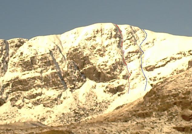
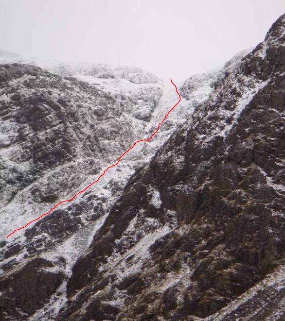
Blue Route 270m II/III
Liam Fahy 10 Jan 2010
This route runs between the main face and the two rock bands on the northern end of the corrie, and meets the summit ridge about 50m north of the summit. The start of the route has a left and a right option, I went right to a snow gully avoiding a longer run of ice on the left. This was a mistake as the snow was soft and deep and the ice in the left gully when I did get across to it was mostly sound and at an easy angle. Most of the route is on snow which became firmer the higher up it went but also started to thin to a mix of snow and frozen turf. The natural line tends right above the second rock band, turn left here onto steepening ground and higher up move right to gain the summit ridge.
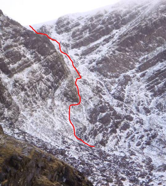
Red Route 305m III
Glenn Watson 8 Jan 2010
The red line I climbed was about III. Mostly easy angled snow with two quite steep ice sections one of 25ft the other 15ft. I bypassed the 25ft section on the right of the gully.
GLENCULLIN CORRIE / COUM DUBH
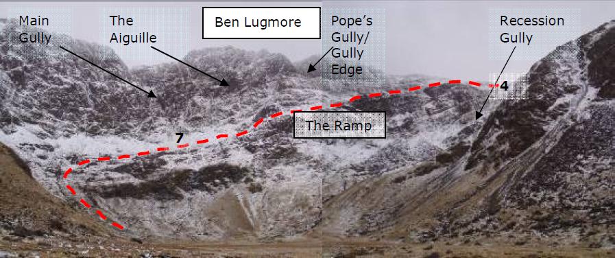
Main Gully as it is referred to on ( http://wiki.climbing.ie/index.php/Mweelrea ) is the obvious gully above the start (bottom) of the ramp, it divides the south east and south west walls of the cwm and finishes in a large funnel shape 300m east of Ben Lugmore west top. Grid for the start of the gully is L81406745.
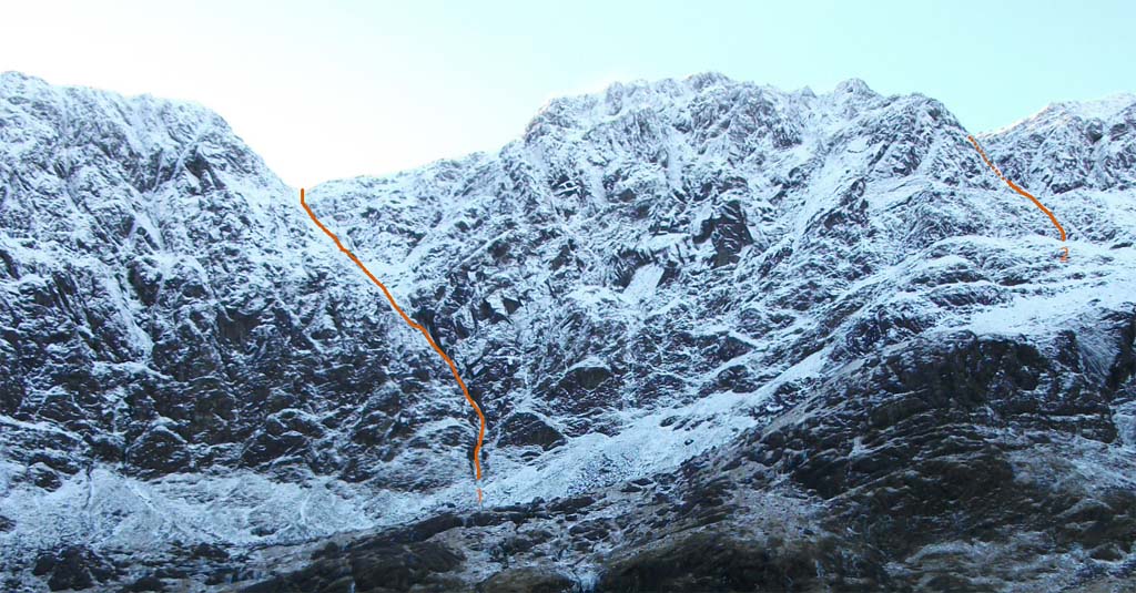
Main Gully IV 5-6 c400m (300m height gain)
First known winter ascent.
Liam Fahy and Glenn Watson 5/12/2010
1. 45m. Up 3 ice steps
2. 20m. Up the ice cascade, Crux 1.
3. 40m. Up easer ice
4. 25m. Up easer ice to base of next rise
5. 20m. Up steepening ice fall, Crux 2.
6. 25m. Up into narrowing gully
7/8. 70-80m. Up easy snow and slightly steeper frozen turf on right (moved together for 20-30m to get belay)
9. 40m. Back left into main gully up snow and one short steep ice step
11. 40m. Up snow and turf to hex and peg belay
12. 40m. Up snow
13. 20m. Easy angled snow to top.
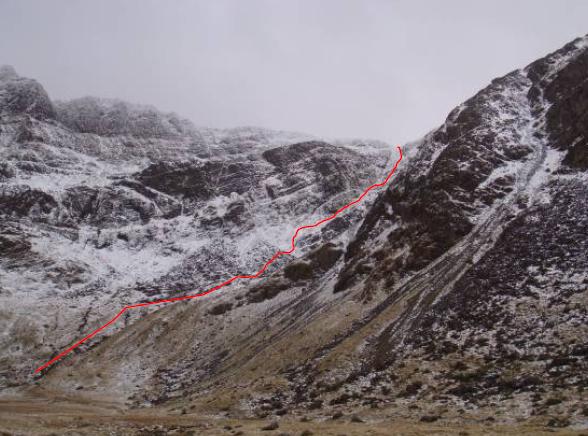
Recession Gully I/II c400m
First known winter ascent.
Conor Warner and Colm O'Coileain 8/02/09
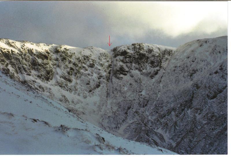
The main gully / ramp in the righthand side corner of the coum.
Photo: Coum Dubh showing Main Features including standard ascent route via The Ramp, Recession gully to the right
The following is an extract from an IMC Journal article about the ascent:
The gully that rises up the right hand side corner of the coum.
We approached the route by following the stream first on the right and then on the left to a boulder field. Above the boulder field a narrow gully then steep / near vertical hillside was climbed (with the aid of an ice axe) to a defined very steep shingle / snow covered gang way between otherwise shear rocky sections. This was followed unpleasantly with increasing steepness and ice to the rim of the main gully. The gully appeared to start much lower down and may prove to be a more direct start. Entering the gully involved negotiating a bulge in the cliff face and a narrow traverse downwards. The gully itself was well snowed up (several feet) though not completely frozen. Colm progressed up the gully while I investigated the ice covered ridge to its right. Climbing in the gully proved to be enjoyable but was soon halted by a 5m vertical ice step. The climbing on ridge was steep with firm ice and snow covered rock. To the right of the ridge was an impressive continuous ice fall which appeared to extend for the complete length of the gully; for another day perhaps.
Colm traversed out of the gully to join me on the ridge and we scouted the route ahead. Down wasn’t a viable option. Up was an ice covered, ever steepening, rock ridge. To the left was a snow filled gully blocked by a vertical ice step and shear ice cover walls. To the right, a large drop down into the icefall and beyond steep ice covered walls. Up the ridge it was. We donned our crampons and progressed steadily on what proved to be excellent snow and ice. Was this really Mayo? The ridge angle relented slightly and then merged with the upper broad section of the gully. We remained on the right side of the gully and made easy progress on continuous steep ice towards the top of the route and eventually to the col between Ben Lugmore and Ben Bury.
Sheeffry Hills
Ben Gorm
Devilsmother/Maumtrasna
LUGA GOWLAN (L967663)
Chimney Gully 213m II
Liam Fahy 6 Jan 2010
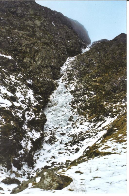
This is the steep sided gully at the back of the east corrie it is the second stream from the left (west to east) on the OS map although it looks like the third on the ground. It’s a snow gully and becomes icy and a little steep to finish
SRAHNALONG VALLEY
An Bothar Fuaire 42m III
Liam Fahy 8 Jan 2010
This was an attempt on “An Bothar Fada” (Srahnalong Valley) in winter condition.
I climbed the first pitch on softening and in places hollow ice but the ice became too thin and soft to trust after that. The gully has its best ice in the shade of the steeper left hand wall (looking up) but the middle section of the gully isn’t as deep and looks to have less Ice and more mixed climbing (maybe it gets more sun?) the upper part looks to have a good covering.
Twelve Bens
BINN BRAOIN / BEN BREEN
Cloud Rake ~150m I/II
N Finney 1 Feb 2019
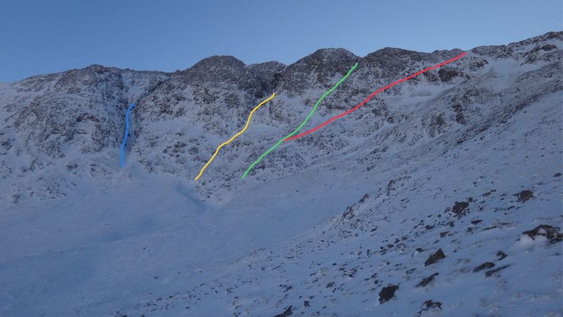
Steep snow gully with two steeper icy pitches. Plenty of snow in the gully but hard work, mostly unconsolidated. Ice on steeper pitches thin and unreliable. Rock / turf better for axe placements. Three other gullies to the left of Cloud Rake on NW face worth exploration (shown in photos)
Route as per Cloud Rake in Alan Tees (Scrambles in Ulster and Connact) on NW Face of Binn Braoin. Approach is from bridge over Owenglin River at GR L74400 51300.
NW Face of Binn Braoin showing three main gullies (blue, yellow, green) and Cloud Rake in Red
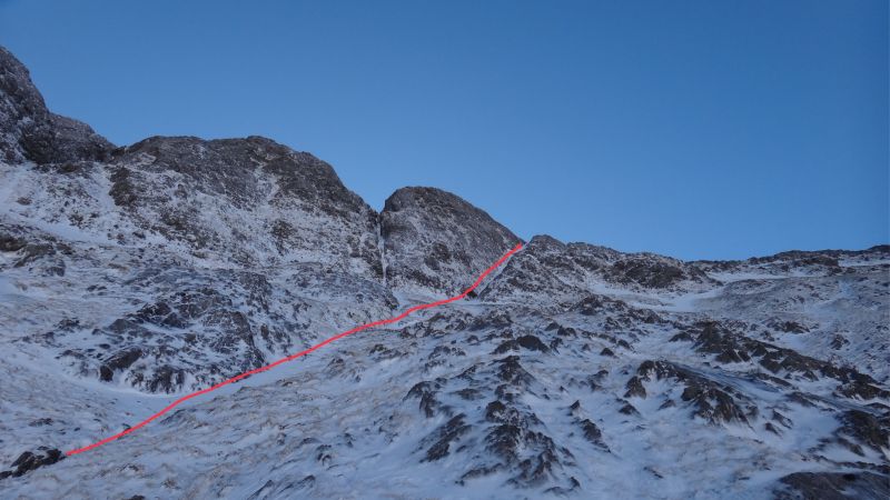
Cloud rake from base of cliff. Climb takes right fork, left fork continues up steeper gully (green in previous photo)
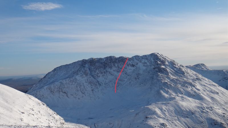
Cloud Rake (red) seen from Binn Baun
