Uncategorized files
From Irish Climbing Wiki
Showing below up to 50 results in range #851 to #900.
View (previous 50 | next 50) (20 | 50 | 100 | 250 | 500)
 Leacht naHamadan overviww.jpg 900 × 473; 190 KB
 Left Pigs Wall-1.jpg 634 × 863; 286 KB
 Left hand apr.JPG 984 × 715; 215 KB
 Left side.jpg 1,144 × 832; 226 KB
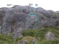 Legover.jpg 2,592 × 1,944; 1,010 KB
 Legspreader burren 08.jpg 2,448 × 3,264; 1,022 KB
 Leic na gCleireach.png 749 × 998; 1.38 MB
 LeicanNiochain.png 998 × 529; 898 KB
 Leitrim2a.jpg 960 × 1,280; 366 KB
 Leitrim 002.jpg 3,000 × 4,000; 2.06 MB
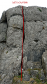 Lets crumble.svg.png 700 × 1,244; 1.67 MB
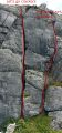 Lets go crackers 2024.svg.jpg 1,000 × 2,151; 968 KB
 Lighthouse Far East.jpg 770 × 338; 45 KB
 Liner.jpg 1,208 × 819; 149 KB
 Listen to the elves.png 750 × 996; 1.24 MB
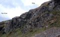 Lk crag nw-vieu.jpg 799 × 500; 197 KB
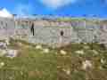 LnB 1.jpg 900 × 675; 262 KB
 Lnahan 1.jpg 900 × 569; 215 KB
 Lnahan 2.jpg 900 × 354; 127 KB
 Lnahan btb1.jpg 850 × 478; 144 KB
 Lnahan btb2.jpg 900 × 506; 204 KB
 Lnahan fb1.jpg 900 × 506; 134 KB
 Lnahan fb2.jpg 547 × 505; 126 KB
 Lnahan fb3.jpg 900 × 506; 146 KB
 Lnahan pts.jpg 850 × 478; 146 KB
 Loafing About.jpg 450 × 600; 188 KB
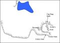 Location.jpg 408 × 296; 17 KB
 Lone Ranger.jpg 856 × 1,093; 204 KB
 Loop Head.jpg 901 × 601; 251 KB
 Loop Head - Bay Slabs.jpg 845 × 634; 320 KB
 Loophead.gif 846 × 421; 12 KB
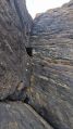 LostWall.jpg 1,080 × 1,920; 812 KB
 Lower buttress Slieve Rua.png 840 × 613; 643 KB
 LuckyManTopo.jpg 3,264 × 2,448; 1.25 MB
 Lug.jpg 778 × 1,167; 312 KB
 MIsland1.jpg 1,944 × 2,592; 1,005 KB
 MIsland2.jpg 471 × 559; 114 KB
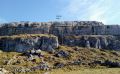 MM.jpg 1,024 × 632; 177 KB
 MMFrenchQtr2.JPG 1,123 × 794; 552 KB
 MM Dougal But.JPG 1,123 × 794; 829 KB
 MM Dougal But 24.jpg 1,123 × 794; 395 KB
 MM Dougal But 25.jpg 1,123 × 794; 394 KB
 MM Doyle But.JPG 1,425 × 759; 519 KB
 MM Doyle But2.JPG 1,123 × 794; 633 KB
 MM French Qtr.JPG 1,123 × 794; 796 KB
 MM left hand.jpg 1,123 × 794; 243 KB
 MTP.jpg 900 × 555; 116 KB
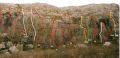 M M.jpg 1,701 × 820; 441 KB
 MagicIslandTopo2.jpg 471 × 559; 114 KB
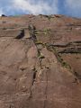 Magic Island Topo 1.jpg 1,944 × 2,592; 1,005 KB


